
Kokolik River
| Introduction | Northern Alaska Map | Kokolik Unassigned Fossils | Fossil Images |
|---|
Interactive map of western northern Alaska showing the positions of the plant fossil localities along the Kokolik River. Some specimens are representative of taxa occuring throughout the Kokolik sections and are unassigned. Where specimens are assigned to specific localities the 'Fossil Images' link becomes active. Locality 98RAS06:69.418175°N -161.361317°W |
|

Locality Description:
Light gray, weathering to yellow/orange very fine sands and silts with clay ironstone (weathering yellow/orange) sheets near the waterline. Clay ironstones are very rich in Desmiophyllum magnum, Pityophyllum (less common), Thallites, Nilssoniopteris and Sphenobaiera. Branch wood and ironstone-preserved logs. Some of these are rooted in the sandstones, but these are rare.
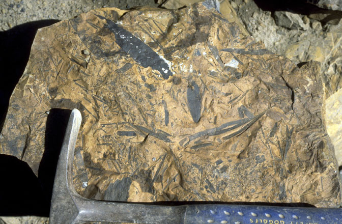 |
Field photograph of fossil leaves (Pityophyllum, Nilssoniopteris, Sphenobaiera, Desmiophyllum etc.) from the Kokolik River sections. |