Locality
Arctic Slope of Alaska locality USGS 11606, north of Maybe Creek. This locality is a bluff approximately 10 m high on the east side of an unnamed tributary of the Price River. The predominant lithologies are bentonitic clays overlying a silty sandstone capped by coal beds up to 2 m thick, which are in turn overlain by a white-gray medium-grained sandstone. Irregularly dispersed throughout the clay are nodules and sheets of ferruginous limestone (sideritic) which, although light gray when fresh, weather to a rusty brown. With the exception of some poorly preserved plant matter in the upper sandstones, and impressions of platanoid leaves in the power sandtsones, the plant material is confined to these fine-grained iron-rich nodules and is preserved as impressions totally lacking cuticle. There is little evidence of post-mortem decay but many leaves are penetrated by vertical fossil rootlets. Platanoid leaves are most common in siltier/sandier facies. The uppermost coal surface supports several in situ tree bases each of which is approximately 20 cm in diameter.
Latitude: 69.528329 °N
Longitude: -153.887128 °W
Description
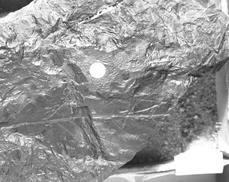
Leaf: simple; symmetrical; narrow elliptic to oblanceolate; apex missing; base decurrent; margin entire; venation eucamptodromous (?); primary midvein moderate, more or less straight, secondary veins weak, sinuous or uniformly curved, angle of origin from the midvein increasing from the base (15°) to apex (45°), basalmost pairs of secondary veins thinner than others and decurrent; intersecondary veins present; tertiary veins indistinct.
Remarks
The poor preservation and fragmentary nature of this specimen makes reliable determination difficult. Eucamptodromy is found in some members of the Magnoliales while the decrease in the angle of secondary vein divergence near the base is a feature of some lauralean leaves.