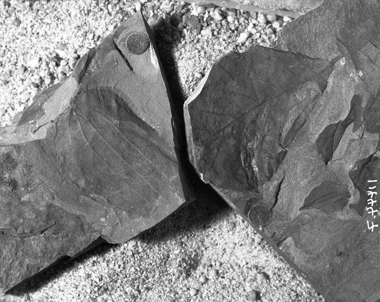
Specimen USGS 11600.7 is in the right of the above image.
Locality
Latitude: 56.268889° N
Longitude: -158.659722° W
Chignik (B-2) Quad.
Collected by R.A. Spicer and J.A. Wolfe.
Floodpain swamp. Lower part of Tolstoi Formation.
Description
Leaf: simple; symmetrical, wide ovate, bilobed; apex emarginate, apices of lobes missing; base acute; petiole normal moderate; margin entire; venation camptodromous; primary vein moderate, straight; secondary veins arising at an acute angle to the midvein (45°), moderate, straight or slightly curved, with brochidodromous loops formed near the margin with several orders of looping; tertiary veins simple but sometimes branched, percurrent, more or less straight.
Remarks
This specimen has been preserved with part of the lamina folded back which reveals the venation prominent on the underside of the leaf. There are many orders of looping near the margin which possibly coalesce to form an intramarginal vein. The lobing is not as pronounced as in Form MA101 to which it is clearly related.