
The Chignik Area
| Map and Localities | Geology | Correlations | Chignik Formation | Tolstoi Formation | Chignik Fossil Images |
|---|
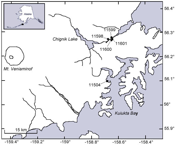
LocalitiesActive links take you to images of fossils found at those localities. 11598 Lat. 56.271111° N Long. -158.675278 °W
|
Map of Chignik localities collected by Spicer, Wolfe and Chase.
|
Hollick LocalitiesLocality descriptions from Hollick (1930), p. 16. Because they use locators that no longer exist or have moved (e.g. river migrations) the descriptions are imprecise and warrant additional investigation to relate the localities to subsequent revisions of the local geology. |
Lot 5796. Collected by W.W.Atwood, 1908. North side of Chignik Bay, 1 mile north of base of sand spit. |
| Lot 11362. Collected by W.R. Smith, 1922. Same locality as Lot 5796. |
| Lot 5799. Collected by W.W. Atwood, 1908. Chignik Lagoon, nearly opposite Alaska Packers Association cannery. |
| Lot 3116. Collected by T.W. Stanton and R.W. Stone, 1904. Whalers Creek, about 1.5 or 2 miles from the shore of Chignik Lagoon. Sandstone underlying the coal-bearing beds. |
| Lot 5795. Collected by W.W. Atwood, 1908. Whalers Creek, about 2 miles from Chignik Lagoon. Series of sandstones about 100 feet below the coal. |
| Lot 11361. Collected by W.R. Smith, 1922. Head of the Creek that flows into Hook Bay. |
| Lot 3485. Collected by Sidney Page, 1905. Big exposure of left fork of Mine Creek, Herendeen bay, just above coal. |
| Lot 3490. Collected by Sidney Page, 1905. About 200 yards above left fork of Mine Creek. Herendeen Bay. |
| Lot 3709. Collected by Sidney Page, 1905. Right barnch of Mine Creek, 200 feet above fork. Herendeen Bay. |
| Lot 3708. Collected by Sidney Page, 1905. Mine Creek, right branch below side stream. Herendeen Bay. |
| S.P. (c). Collected by Sidney Page, 1905. Just above Johnson Tunnel. Herendeen Bay. |
| Lot 5184. Collected by W.W. Atwood, 1908. Mine Creek, Herendeen Bay. "Coal series". |
| Lot 539. Collected by C.H. Townsend, 1890. Cut on tramway, about a mile from the head of Mine Harbour, Herendeen Bay, within a few hundred yards of the mine. |
| Lot 5185. Collected by W.W. Atwood, 1908. Coal Bluff, east shore of Herendeen Bay. "Coal Series". |
| Lot 5187. Collected by W.W. Atwood, 1908. Canyon 2 miles west of mouth of creek about the middle of the west shore of Mud Bay, Port Moller. Shale bed. |
| Lot 5296. Collected by W.W. Atwood, 1908. North shore of Chignik River, just below Long Bay. |
| Lot 5297. Collected by W.W. Atwood, 1908. North shore of Chignik River, just below Long Bay. About 30 feet above 5926. |
| Lot 5580. Collected by W.W. Atwood, 1908. Canyon on east face of Pinnacle Mountain, near summit, near head of Herendeen bay. |
| Lot 5588. Collected by W.W. Atwood, 1908. West side of Buck Valley, about 1.5 miles from shore of Herendeen Bay. |
| Lot 3121. Collected by G.C. Martin, 1904. North shore of Kaguyak bay, 1 mile east of mouth of river. |
| Lot 5189. Collected by W.W. Atwood, 1908. East side of Pavlov Bay. |
| Lot 5793. Collected by W.W. Atwood, 1908. South shore of Chignik Bay just west of end of Chignik Head. |
| Lot 3525. Collected by T.W. Stanton and R.W. Stone, 1904. East shore of Doris Cove, Chignik Bay. |
| Lot 3521. Collected by T.W. Stanton and R.W. Stone, 1904. South shore of Chignik Bay, 2 miles northeast of Alaska Packers Association cannery, opposite end of sand spit. Talus which evidently came from one of the shaley layers not far above the base of the exposure. |
| Lot 3115. Collected by T.W. Stanton and R.W. Stone, 1904. Same locality as 3521. Sandstone fragments in talus. |
| Lot 5295. Collected by W.W. Atwood, 1908. South shore of Chignik Lagoon nearly opposite the end of the sand spit. |
| Lot 3114. Collected by T.W. Stanton and R.W. Stone, 1904. South shore of Chignik Lagoon, 200 yards southwest of native village, about 1 mile northeast of Alaska Packers Association cannery. Dark shale. |
| Lot 5797. Collected by W.W. Atwood, 1908. South shore of Chignik Lagoon, about 200 yards south west of native village. |
| Lot 5294. Collected by W.W. Atwood, 1908. Anchorage bay, opposite Northwestern Fisheries cannery. |