
The Chignik Area
| Map and Localities | Geology | Correlations | Chignik Formation | Tolstoi Formation | Chignik Fossil Images |
|---|
GeologyGeologic investigations on the Alaska Peninsula began over 200 years ago when G.W. Steller accompanied Vitus Bering in 1741 on the voyage that discovered Alaska. We are not aware of any studies carried out by Russian geologists before Alaska was sold to the United States in 1867, but after that Dall (1870, 1882, 1896, 1898) and Dall and Harris (1892) explored many parts of the peninsula and established a stratigraphic nomenclature. The early 20th Century witnessed further exploration with contributions from Atwood (1911), Capps (1923, 1934), Knappen (1929), Martin (1905, 1916,1921, 1925, and 1926), Mather (1925), Paige (1906), Smith (1925a, 1925b), Smith and Baker (1924), and Stone (1905) who further developed the stratigraphic nomenclature. The Alaska Peninsula constitutes the main part of what has been called the Peninsular terrane (Jones and others, 1981) and, more recently, the Alaska Peninsula terrane (Wilson and others, 1985) and was part of an active continental margin that may have been accreted to North America during the Jurassic (Jones and others, 1978; Stone and others, 1982). The Triassic and Lower Jurassic lithology and faunal content suggest a depositional source at low paleolatitudes, a conclusion supported by paleomagnetic studies that suggest the site was at about 15" N. (Hillhouse, 1977). By Middle Jurassic time marine fossils, mainly ammonites, show that the Alaska Peninsula had moved to near its present latitude (Taylor and others, 1984). |
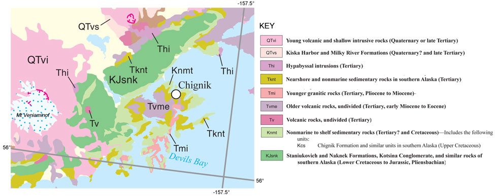 |
| Geologic Map of the Chignik area extracted from Wilson et al. (2105). |