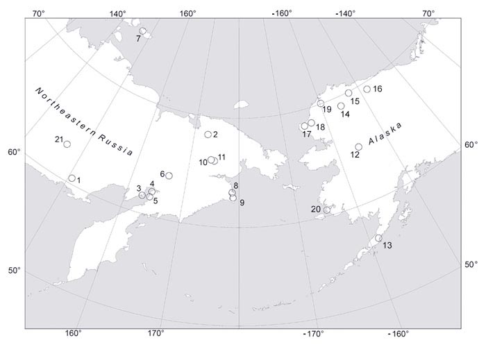
MapsThis page is the gateway to a series of maps showing the locations of assemblages of plant fossils (taphofloras). The maps are interactive in that clicking on an area or an individual numbered location takes you to further maps or information on taphofloras within that area or location. Clicking on a name in the legend takes you directly to a page relating to that taphoflora. This map shows the areas in Northeastern Russia and Alaska where Cretaceous and Paleogene taphofloras have been found. In general decimal degrees are used as map co-ordinates. In this scheme longitudes in the western hemisphere are designated as negative and those in the eastern hemisphere are positive. Latitudes in the Southern Hemisphere are negative while those in the Northern Hemisphere are positive. An example is shown on the margins of the map on the right. |
1) Arman River; 2) Chauna; 3) Yelistratov Peninsula; 4) Cape Valizhgen; 5) Cape Konglomeratoviy; 6) Grebenka River Area; 7) Novaya Sibir; 8) Ugol'naya Bay; 9) Amaam Lagoon; 10) Pekul'nei Ridge, West; 11) Pekul'nei Ridge, East; 12) Yukon–Koyukuk Basin; 13) Chignik; 14) Upper Colville and Chandler Rivers region; 15) Lower Colville River; 16) Sagavanirktok River area; 17) Corwin Bluffs area; 18) Kokolik, Kukpowruk Rivers; 19) Kuk–Kaolak area; 20) Nelson/Nunivak Island; 21) Arkagala. |