Website Banner


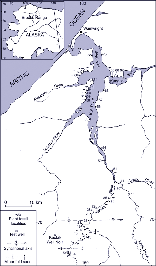
Maps - Kuk and Kaolak Rivers Area

Locality Relationships          


This map shows the localities along the Kuk and Kaolak Rivers sampled by Smiley (reported in Smiley, 1966). Click on the localities for links to images of the fossils found. If a locality is not linked it is because no images are available.


Kuk and Kaolak localities map
   
Table showing the relationships between lithologic units and florule composition in the Kuk River area, modified from Smiley (1966).   Table showing the relationships between litghologic units and florule composition in the Kuk River area (Smiley, 1966)


Hotspot linking to  Hotspot linking to Kaolak locality14 Hotspot linking to Kaolak locality16 Hotspot linking to Kaolak locality 18 Hotspot linking to Kaolak locality 19 Hotspot linking to Kaolak locality 21 Hotspot linking to Kaolak locality 26 Hotspot linking to Kaolak locality 28 Hotspot linking to Kaolak locality 29 Hotspot linking to Kaolak locality 34 Hotspot linking to Ketik (Kuk) locality 44 Hotspot linking to Kuk65 Hotspot linking to Kuk 66 Hotspot linking to Kuk67 Hotspot linking to Ketik (Kuk) 50 Hotspot ;linking to Ketik (Kuk) 41 Hotspot linking to Kuk locality 51 Hotspot linking to Kuk locality 52 Hotspot linking to Kuk locality 54 Hotspot linking to Kuk locality 55 Hotspot linking to Kuk locality 56 Hotspot linking to Kuk locality 58 Hotspot linking to Kuk locality 68 Hotspot linking to Kuk locality 69 Hotspot linking to Kuk locality 70 Hotspot linking to Kuk locality 71 Hotspot linking to Kuk locality 72