Locality
Kukpowruk River, Locality 96-19, mapped as Corwin Formation. Late Albian to early Cenomanian.
Latitude: 69° 16' 06" N
Longitude: 162° 47' 24" W
Remarks
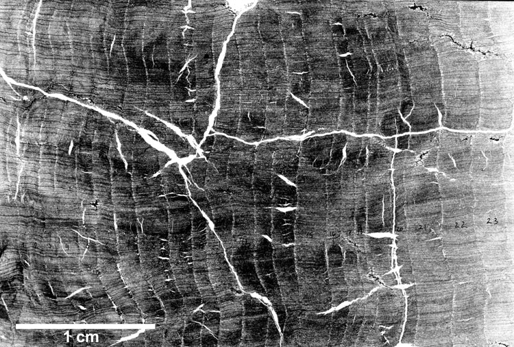
This transverse section is of a wood sample taken from a standing tree base 35-40 cm diameter, preserved vertical to bedding surrounded by gray/brown silty mudstone with ironstone nodules, lumpy texture, no obvious rooting. The ring structure and some cellular detail is apparent in the cross section taken from near the top of the exposed trunk. The bottom of the stump was excavated to a depth of approximately 1m but the root flair was not reached. The tree was possibly rooted in a dark gray shale that lateral exposures showed underlay the silty mudstone. Ironstone nodules in this shale contained large Pityophyllum and large Podozamites leaves. The silty mudstone became darker gray and more obviously laminated in its upper part before being covered by light gray fine sandstone. The top of the stump was abraded and protruded into a hollow in the underside of this sandstone.