
Upper Colville River, Alaska
| Upper Colville Fossil Images Unassigned | No Images for 85JTP03 |
|---|
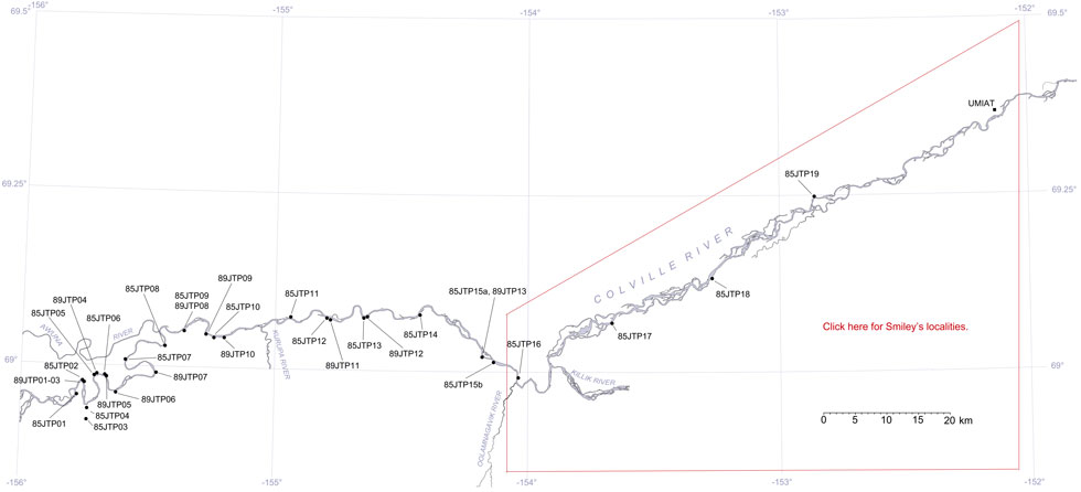
This interactive map of part of the Colville River, Northern Alaska, shows the locations of plant fossil collections made by J.T. Parrish and R.A. Spicer in 1985 and 1989. Click on a number for more details on that site. The red outlined area links to another map showing positions of florules (plant fossil assemblages) collected by C.J. Smiley along both the Colville and Chandler Rivers. |
Locality 85JTP03
This locality, and 85JTP04, is on Kucher Creek, a tributary of the Colville River. Exposures are mapped as representing the marine Tuktu Formation of Chapman et al. (1964), are limited and only yielded wood fragments in yellowish to green gray cross-bedded fine to medium grained sandstones. The sands are possibly slightly glauconitic. Twig wood sometimes occurs with mud rip ups. If this is marine it it near shore and shallow, but in the absence of marine fossils these localities could represent fluvial distributary channels in a marginal marine setting.