Sagavanirktok River - Sagwon Section
| Sagwon Coals and Floras | Section 1 | Section 1.5 | Section 2 | Sections 3 and 4 | Sagwon Fossil Images |
|---|
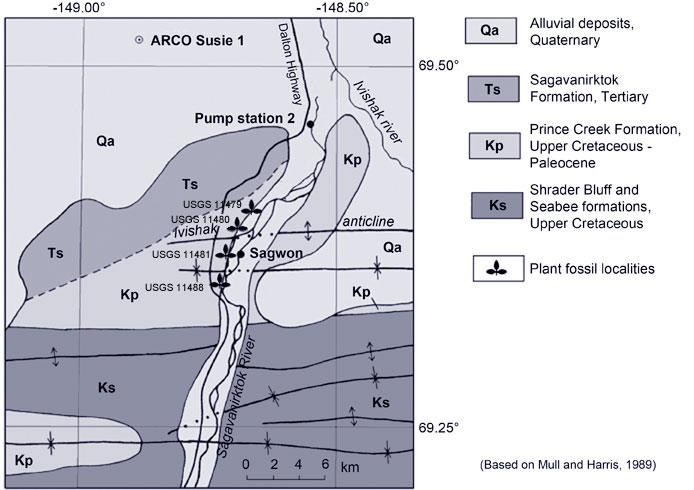
Sagwon AreaSagwon (Sagavanirktok One) is the name of a now abandoned camp built to service the construction of the trans-Alaska oil pipeline. Little now exists except an overgrown airstrip. The bluffs to the west of Sagwon expose highly fossiliferous non-marine sandstones, mudstones, claystones and coals belonging to the middle Paleocene (Selandian) parts of the Prince Creek Formation. Originally thought to encompass the K-Pg boundary, the plant-bearing beds contain pollen that, although some Cretaceous forms are present, is more typical of the middle Paleocene (Daly et al., 2011). Overlying the Prince Creek Formation is the Sagwon Member of the Sagavanirtktok Formation. The contact between the predominantly fine grained sediments of the Prince Creek and the pebble conglomerates and sandstones of the Sagwon Member is sharp, erosional, and represents a sequence boundary. |
|

 |
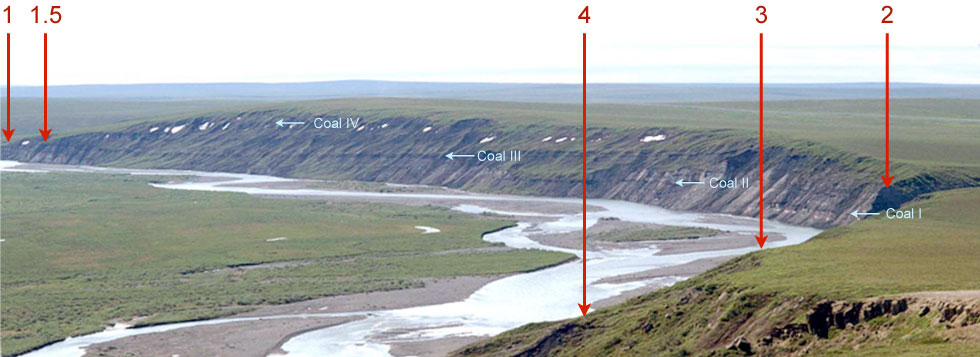
Above - Bluffs to the west of Sagwon along the Sagavanirktok River, looking SSW, showing the locations of measured sections. The axis of the Ivishak Anticline runs through the valley at the extreme right of the image where section 2 was measured. | |
|---|---|---|
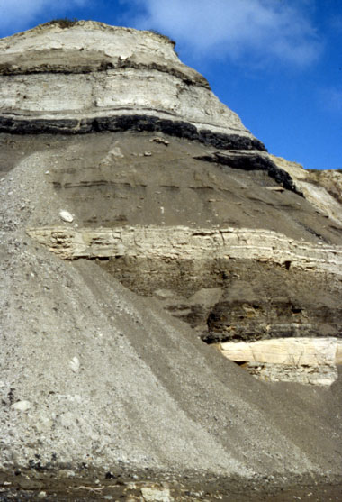
The Sagwon Member has been dated as late Paleocene based on pollen (Mull et al., 2003; Frederiksen et al. 1996). The total thickness of Prince Creek and Sagwon Member sediments exposed along the section is about 120 m. In contrast to the conglomerates of the basal Sagwon Member the Prince Creek Formation sandstones are typically fine-grained and cross-bedded, representing large meandering rivers. Overbank mudstones and lacustrine claystones make up most of the sediments and contain numerous siderite nodules that can be highly fossilferous. Coal seams, often several meters thick are laterally continuous along the length of the section, although frequently offset by low angle faulting as can be seen in the photograph to the left. The coals reveal few leaves but are composed of numerous compressed logs and are often fusain-(charcoal)-rich evidencing the frequent occurrence of wildfires in Selandian times. For more details of the sedimentology and graphic logs of measured sections click here. |
||
| Left - A succession of fluvial sandstones, overbank mudstones, lacustrine shales and coals of the Prince Creek Formation exposed in the Sagwon Bluffs section towards the right side of the image above. | ||
According to Mull et al. (2003) "the Sagavanirktok Formation in the eastern Colville basin consists of three mappable, northeasterly prograding sequences, each of which is characterized by a basal unit of coarse clastic fluvial sediments that grade upward into finer grained sediments that are commonly bentonitic and contain coal or lignite beds. The base of each sequence is marked by the occurrence of poorly consolidated sandstones and conglomerates that interfinger basinward (to the east and north) and upward into poorly consolidated, carbonaceous siltstone, bentonitic mudstone, and coal or lignite". It would seem that the conglomerates of the basal Sagwon Member mark the start of this different style of sedimentation. The finer grained sediments above the conglomerates are also rich in leaf fossils, no more so than in the red baked shales exposed in the White Hills to the northwest of Sagwon. Those fossils are not illustrated on this website. |
 |
|
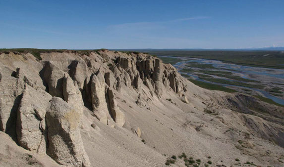
| Conglomerates forming the basal part of the Sagwon Member of the Sagavanirktok Formation exposed at the top of the northern end of the Sagwon section. |

