Upper Colville River, Alaska
| Upper Colville Fossil Images Unassigned | Fossil Images 85JTP05 |
|---|
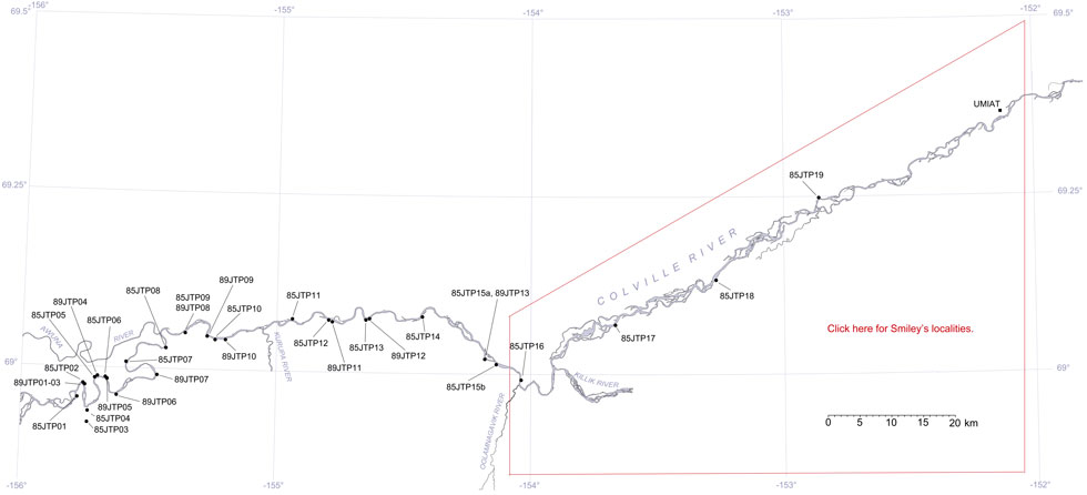
This interactive map of part of the Colville River, Northern Alaska, shows the locations of plant fossil collections made by J.T. Parrish and R.A. Spicer in 1985 and 1989. Click on a number for more details on that site. The red outlined area links to another map showing positions of florules (plant fossil assemblages) collected by C.J. Smiley along both the Colville and Chandler Rivers. |

Locality 85JTP05
This locality is mapped as belonging to KcKt (lower part of the Killik Tongue of the Chandler Formation and Tuktu Formation undifferentiated, Chapman et al., 1964). Mull et al. (2003) reassigned this unit to the middle part of the Nanushuk Formation.
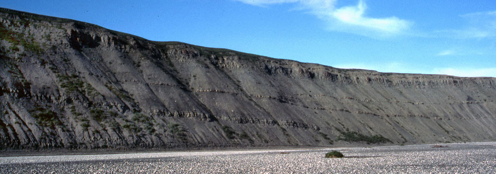
Locality 85JTP05 is at the west (left) end of the section shown below. Numerous abraded woody fragments occur in well defined 'debris beds'. Planar laminated siltstones and very fine sandstones are interpreted as a fluvial overbank succession.There is evidence of coal in weathered scree but the coal bed was not exposed in 1985. Indurated claystones occur in a fine silt/sandstone succession containing Nilssonia, Sphenobaiera, ferns, conifer fragments (Pityophyllum) and Podozamites. Many of the remains are flow oriented. Fern fragments are preserved at various angles and the bedding is poorly developed. This is interpreted as an assemblage of rapidly inwashed material from nearby. The more woody fragments and Podozamites are more common in the sandier units. Some 45 m downstream a coal overlies a sandstone. The sandstone contains muddy surfaces with worm-like trace fossils, pebble stringers and some ripple marks, together with an abundance of water-worn wood fragments 1-3 cm in length. The bedding is mostly planar but with localised cross-bedding. The coal is apparently in place (the dip is consistent with units that are in place). The basal part was covered, but was not more than 2.5 m thick. The upper part is finely laminated to shaley and abruptly passes up into a gray/brown mudstone below a sandstone that is immediately overlain by a fine to medium sandstone with clay laminae with worm tracks, inoceramid shells, and water-worn plant material and is interpreted as being marine.
 |
| The predominantly marine section near localities 85JTP05, 85JTP06, 89JTP04, and 89JTP05. |
These marine fine to medium sands with pebble stringers and worm traces in the often ripple marked clay laminae are overlain by poorly indurated fine sands with concretions. This is immediately overlain by poorly-indurated fine sands, again with concretions, gray claystones with beds of siltstones and gray-yellow fine sands in total approximately 6 m thick. The frequency of the fine sand units, and their thicknesses, increase upwards. These fine sand successions pass into gray shale/mudstones, yellow-weathering fine sandstones and then into green-gray fine sandstones with well rounded pebble stringers and conglomerates where black chert pebbles are common. The frequency of wood fragments increases upwards.
 |
Lithological column for locality 85JTP05 as recorded by J.T. Parrish in July 1985. |
