
Upper Colville River, Alaska
| Upper Colville Fossil Images Unassigned | No megafossils images |
|---|
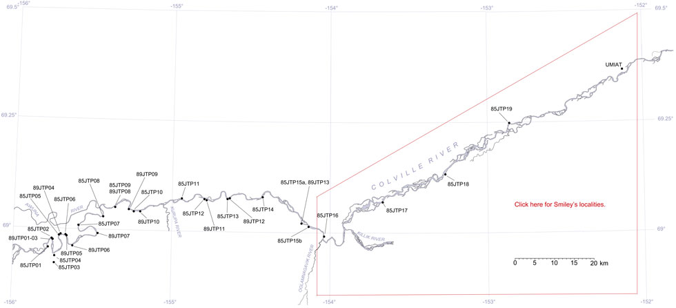
This interactive map of part of the Colville River, Northern Alaska, shows the locations of plant fossil collections made by J.T. Parrish and R.A. Spicer in 1985 and 1989. Click on a number for more details on that site. The red outlined area links to another map showing positions of florules (plant fossil assemblages) collected by C.J. Smiley along both the Colville and Chandler Rivers. |
Locality 85JTP19
This is an exposure of the middle part of the Nanushuk Formation of Mull et al. (2003), formerly referred to as the Grandstand Formation of Chapman et al. (1964). It is a predominantly gray clay/siltsone/shale succession with more indurated siltstone and sandstone units. Carbonaceous plant hash occurs together with shell fragments. Invertebrate trace fossils (worm tubes) abound in distinct horizons. Plant fragments include branches up to 2.5 cm in diameter. Only pollen samples were collected.