Website Banner


The Yukon-Koyukuk Localities of Hollick (1930)

Introduction Geology Hollick Localities Spicer Localities Locality Relationships Wider Correlations  


Interactive map of Hollick's 1930 localities along the Yukon River. Hotspot linking to Yukon locality 3248, 4633, 4634 Hotspot linking to fossil images from Hollick's yukon locality 2963 Hotspot linking to Yokon locality 3249 Hotspot linking to Yukon localities 3248, 4633,4634 Hotspot linking to Yukon localities 3248, 4633, 4634 Hotspot linking to Yukon locality 4637 Hotspot linking to Hollick's Yukon locality 3254 Hotspot linking to Yukon locality 4638 Hotspot linking to Yukon locality 3260 Hotspot linking to Hollick's Yukon locality 3253 Hotspot linking to Hollick's Yukon Locality 2964 Hotspot linking to Hollick's Yukon locality 3258 Hotspot linking to Hollick's locality 3259 Hotspot linking to Hollick's Yukon locality 3264 Hotspot linking to Hollick's Yukon locality 3265 Hotspot linking to Yukon locality 3267 Hotspot linking to Yukon localities 2985, 3269, 4641, 4642 Hotspot linking to Yukon localities 2985, 3269, 4641, 4642 Hotspot linking to Yukon localities 2985, 3269, 4641, 4642 Hotspot linking to Hollick localities 2962, 3252, 4635, 4636 Hotspot linking to Hollick localities 2983, 3266 Hotspot linking to Yukon localities 2984, 3268, 4640 Hotspot linking to Hollick's localities 3255, 3256 Hotspot linking to Yukon localities 3261, 4639 Hotspot linking to Yukon localities 3271, 4643

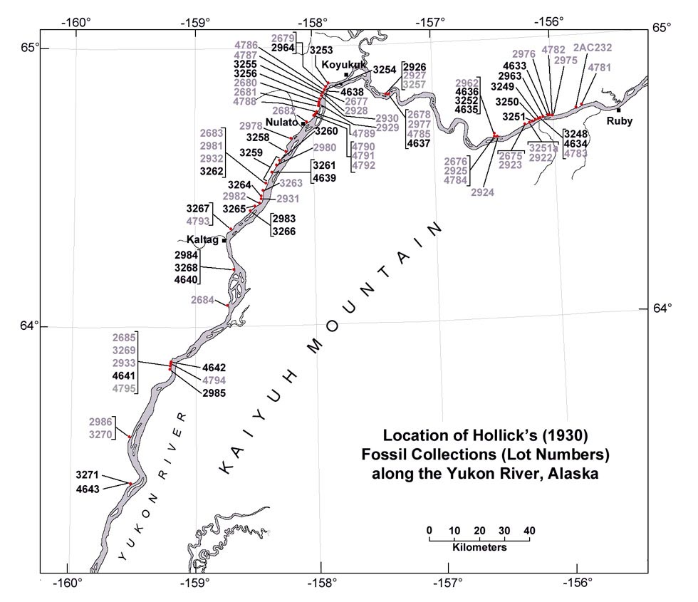
Interactive map showing plant fossil localities along part of the Yukon River, Alaska, as reported in Hollick (1930). Longitudes and latitudes are in decimal degrees. Click on a black locality number for links to images of fossils found at that site. gray numbers are localities (Lot numbers) listed in Hollick (1930) but for which there are no images.