Geology
| Introduction | Alaska | Russia | Paleogeography | Energy Resources |
|---|
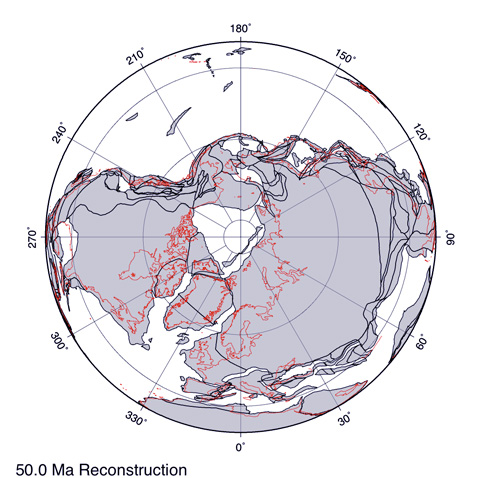
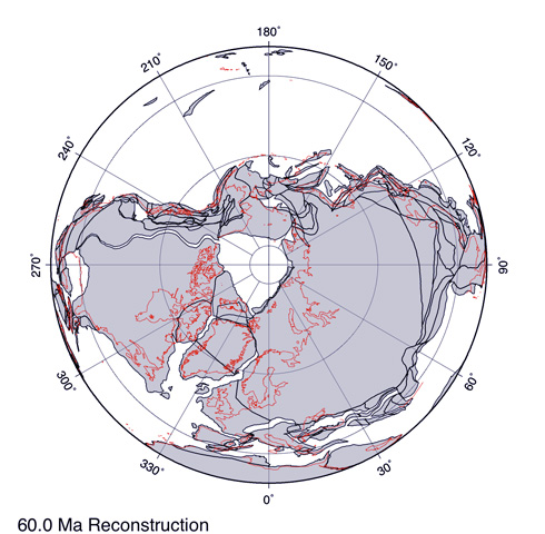
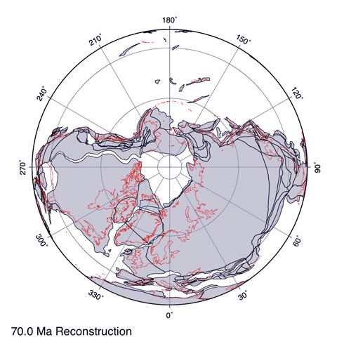
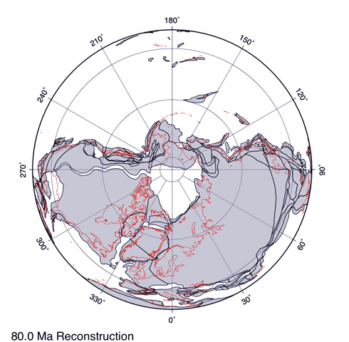
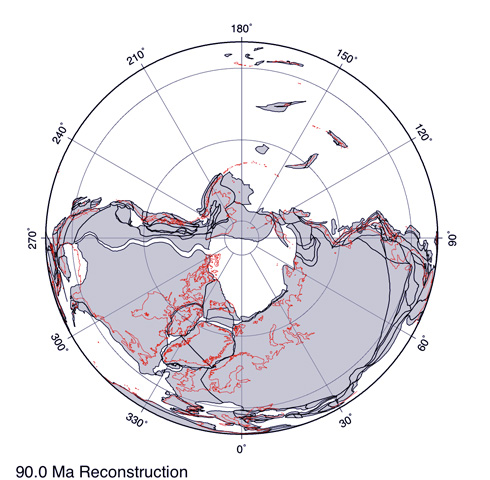
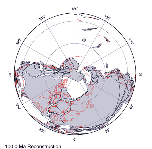
PaleogeographyEvolution of the ArcticThe maps to the right show a North polar orthographic projection between 100 million years ago (mega annum or Ma) and 50 Ma. The positions of modern coastlines are given in red for easy reference. The plates are shown as lavender gray areas. The 'cross hairs' at the centre of each map shows the position of the ancient magnetic north pole. Latitude is in 30° increments. Throughout the Late Cretaceous and into the Paleogene Northeastern Russia and Alaska were positioned above paleolatitude 66 °N. Assuming an obliquity similar to that of today and a congruence of the rotational and magenetic poles (Lottes, 1987) they were both within the paleo-Arctic circle. Northern Alaska was above 75 °N for much of this time. Taken together the Russian and Alaskan floras represent the highest latitude Late Cretaceous vegetation that is accessible anywhere in the world and provides an unparalleled insight into polar vegetation at a time of an extreme global 'greenhouse' climate. In the early part of the Late Cretaceous plate movements eliminated the deep water connection to the Pacific and the Arctic Ocean remained relatively enclosed and isolated from the rest of the world's oceans throughout the rest of the Late Cretaceous and well into the Paleogene. Only shallow water connections allowed interchange of sea water and marine biota. Despite this the Arctic Ocean seems to have been much warmer than now, or at least it's surface waters were, although temperature estimates vary (Spicer and Herman 2010).
Ocean Currents
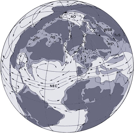
Hypothetical reconstruction of the Northern Hemisphere ocean currents (arrows; arrow length approximately corresponds to the strength of a current) in the Late Cretaceous (modified from Herman, 2013; paleogeography for the late Maastrichtian after Ziegler and Rowley, 1997); deep seas are shown in light grey, shallow seas in grey and land in dark grey; AO – Arctic Ocean, HS – Hudson Straight, NEC – North Equatorial Current, RS – Russian Straight, TS – Teichert Straight, TuS – Turgai Straight, WIS – Western Interior Seaway, WSB – West Siberian Basin.
|
 |
|
 |
||
 |
||
 |
||
 |
||
 |
||
Maps generated by the ODSN website: http://www.odsn.de/odsn/services/paleomap/paleomap.html |