
Kokolik River
| Introduction | Northern Alaska Map | Kokolik Unassigned Fossils | Fossil Images |
|---|
Interactive map of western northern Alaska showing the positions of the plant fossil localities along the Kokolik River. Some specimens are representative of taxa occuring throughout the Kokolik sections and are unassigned. Where specimens are assigned to specific localities the 'Fossil Images' link becomes active. Locality 98RAS01:69.352381°N, -161.451077°WSpecimens:98RAS01.1 (wood)98RAS01.2 (wood) |
|

Locality Description:
Unit 1- Light gray to yellow/brown fine sand with comminuted plant debris, rounded branch fragments, no marine fossils. Ripples with wavelengths 10-15 cm, amplitudes 2-3 cm, oftern two sets normal to one another with fine lamination and clay drapes possibly indicating tidal influence. Unit 2 - gray, silty claystone with orange-weathering ironstone nodules with fragmented Podozamites, Pityophyllum, Sphenobaiera, Equisetites and Desmiophyllum magnum.
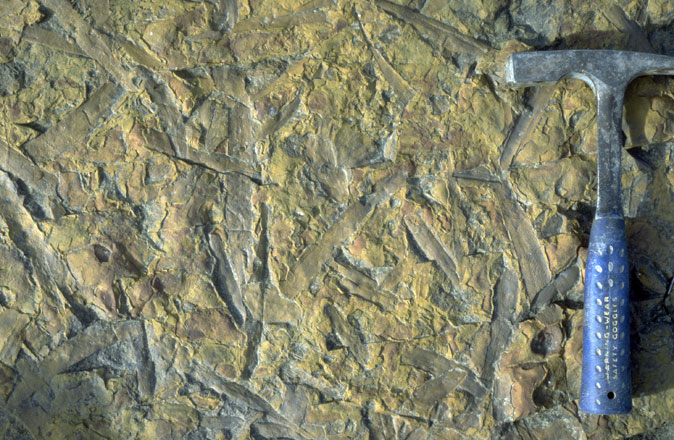 |
Field photograph of isolated Podozamites leaves. |