
Kokolik River
| Introduction | Northern Alaska Map | Kokolik Unassigned Fossils | Fossil Images |
|---|
Interactive map of western northern Alaska showing the positions of the plant fossil localities along the Kokolik River. Locality 98RAS11:69.529355°N -161.354152°W
|
|

Locailty Description:
A series of poorly exposed fine to medium light gray (sometimes ironstained to orange) sandstones with Thallites, Nilssonia serotina (whole fronds) and plant debris. At the east end of the outcrop (upstream) burrows seen in some sandstones otherwise more or less unfossiliferous. Logs compressed in sands and some structurally preserved. Thin coals also in the succession. Equisetites rhizomes in sands near the east end of the outcrop (near the burrows). A few rare, poorly preserved Cladophlebis seen approximately 750 m downstream.
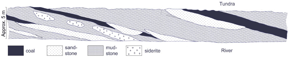
Field sketch of the 98RAS11 locality showing the principal lithologies. Vertical scale exaggerated. The siderite shows as orange bands in the photograph below.
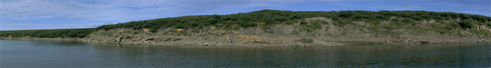
Composite panoramic photograph of the 98RAS11 locality.