Website Banner


Lower Colville River, Locality 86/58

Northern Alaska Map         Leaf Fossils


Kogosukruk Tongue of the Prince Creek Formation. Between this and the previous section a bone fragment and a small tree base 15 cm in diameter were found as float. This section is a continuation of that previous section at locality 86/57.

An olive green-gray riooted clay forms the base of the section. This is overlain by 30 cm of carbonaceous silt with abundant plant fragments and aconcretionary layer halway through it. Above this a very heavily rooted gray clay some 90 cm in thickness passes up into a thin (5 cm) brown clayey seat earth underlying a 7 cm thick brown coal, a 5 cm thick well indurated coaly claystone, a 20 cm thick sandy peat and an 18 cm thick brown coal. Above this a 2.5 cm gray clay underlies a weakly rooted white-weathering clay (possibly bentonitic and thus representing a minor ash fall) with exquisitely preserved ferns (Arctopteris aff. rarytkinensis) in a compressed but upright (growth) position (Samples 86RAS268). This is overlain by a light gray abundantly rooted clay with fern fragments (27 cm thick) and a brown carbonaceous clay.


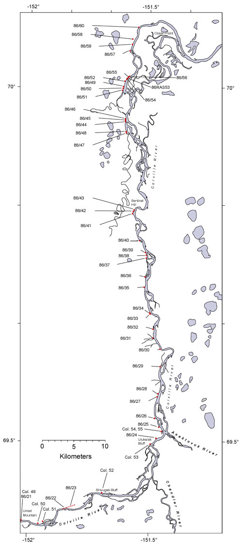
  Map of the colville River below Umiat Hotspot linking to page describing locality 86/21 Hotspot linking to page describing locality86/22 Hotspot linking to page describing locality 86/23 Hotspot linking to page describing locality 86/24 Hotspot linking to page describing locality 86?25 Hotspot linking to a page describing locality 86/26 Hotspot linking to a page describing locality 86/27 Hotspot linking to a page describing locality 86/28 Hotspot linking to a page describing locality 86/29 Hotspot linking to a page describing locality 30 Hotspot linking to a page describing locality 86/31 Hotspot linking to a page describing locality 86/32 Hotspot linking to a page describing locality  86/33 Hotspot linking to a page describing locality  86/34 Hotspot linking to a page describing locality  86/35 Hotspot linking to a page describing locality  86/36 Hotspot linking to a page describing locality  86/37 Hotspot linking to a page describing locality 86/38 Hotspot linking to a page describing locality 86/39 Hotspot linking to a page describing locality  86/40 Hotspot linking to a page describing locality  86/41 Hotspot linking to a page describing locality  86/42 Hotspot linking to a page describing locality  86/43 Hotspot linking to a page describing locality  86/44 Hotspot linking to a page describing locality  86/45 Hotspot linking to a page describing locality 86/46 Hotspot linking to a page describing locality 86/47 Hotspot linking to a page describing locality 86/48 Hotspot linking to a page describing locality 86/50 Hotspot linking to a page describing locality 86/52 Hotspot linking to a page describing locality 86/53 Hotspot linking to a page describing locality 86/55 Hotspot linking to a page describing locality 86/57 Hotspot linking to a page describing locality 86/59 Hotspot linking to a page describing locality 86/60 Hotspot linking to a page describing Smiley's locality Co. 49 Hotspot linking to a page describing Smiley's locality Col. 50 Hotspot linking to a page describing Smiley's locality Col. 51 Hotspot linking to a page describing Smiley's locality Col. 52 Hotspot linking to a page describing Smiley's locality Col. 54_55
  Interactive map of the lower reaches of the Colville River showing plant fossil localities sampled by Smiley (1969) and by Parrish and Spicer in 1986.
     
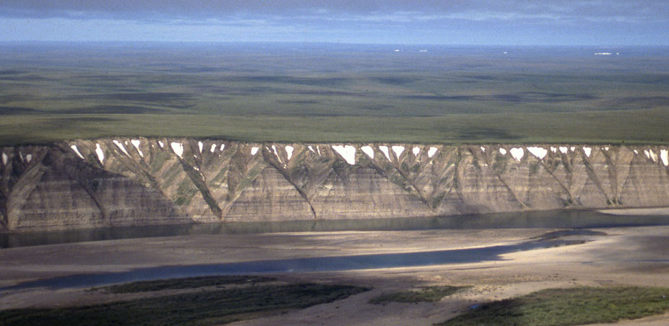
Field photograph from the air showing exposures of the Prince Creek Formation along the western side of the Colville River
 
Part of the exposure of the Prince Creek Formation (formerly the Kogosukruk Tongue of the Prince Creek Formation) on the western side of the Colville River between Uluksrak Bluff and Ocean Point.