
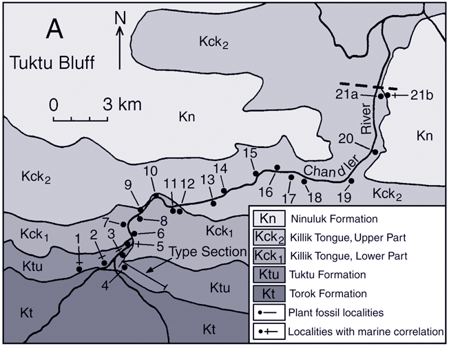
Chandler River Tuktu Bluff
| Map of Northern Alaska | Map of Upper Colville River Area | Map of Lower Colville River Area | Smiley Colville-Chandler Map |
|---|
| Tuktu Bluff | Tuluvak Bluff |
|---|
Tuktu Bluff SectionThis map shows the localities along the Chandler River Tuktu Bluff section sampled by Smiley (reported in Smiley 1969a). Click on the localities to see links to images of the fossils comprising the florules. Click here for an updated stratigraphic nomenclature. |
 |