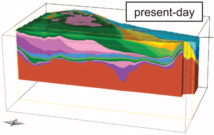
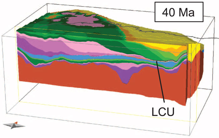
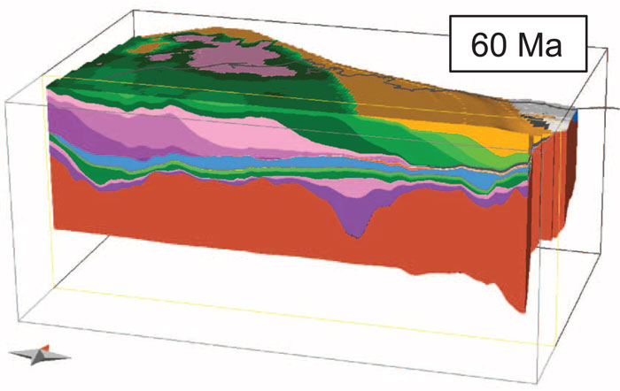
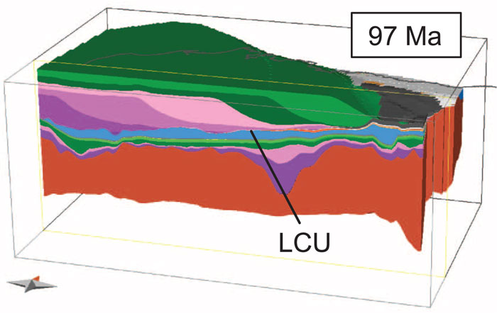
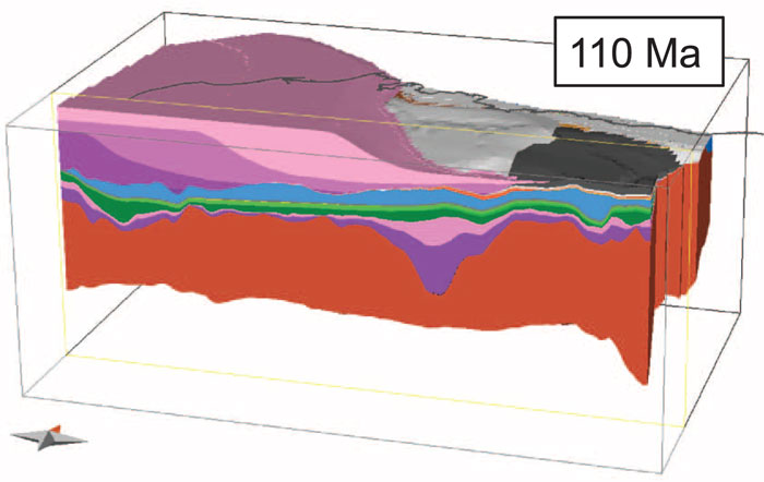
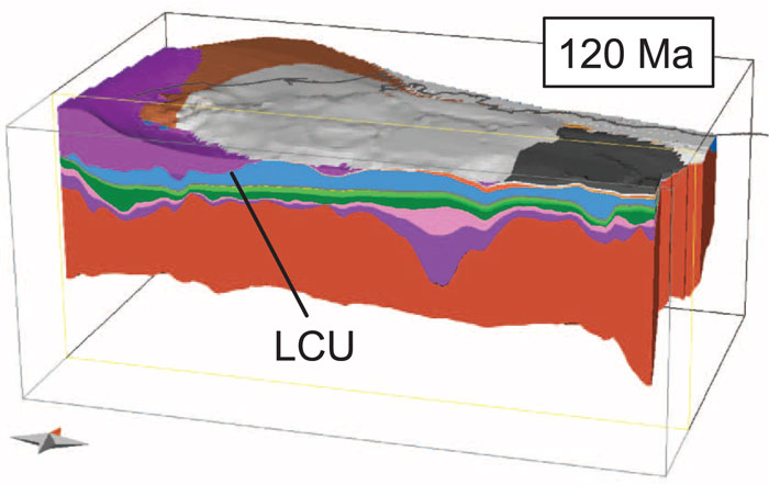
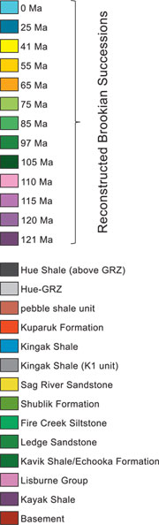
| Using 48,000 km of two dimensional seismic data and information from over 400 boreholes Schenk et al. (2012) modelled the 3D structure of Northern Alaska. Below are selected time slices showing the modeled progradation of the middle Cretaceous to Present deltaic deposits (the Brookian Successions) from southwest to northeast across northern Alaska. The view is from the south looking roughly North-Northwest. The cut plane (in front) is located in the deepest part of the Colville Basin. The Cretaceous rock are underlain by the Lower Cretaceous Unconformity (LCU). The present day coastline is indicated by the black line. Hue-GRZ = Hue–Gamma Ray Zone. |
|
 |